Personal locator beacons: Salvation for all

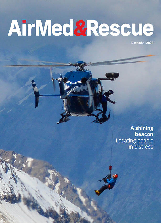
Satellite personal locator beacon technology still dominates but cellular networks and combination devices increasingly offer an alternative. Rob Coppinger explores the options
New technology for personal locator beacons (PLBs) is enabling faster response times for search and rescue (SAR) providers, with the latest generation of SAR beacons, detectors and networks slowly entering new sectors and, increasingly, the civilian market as well.
Since September 2022, people with the Apple iPhone 14 or the larger iPhone 14 Plus have been able to select an emergency SAR function that sends a signal to a satellite, not a cellular network tower, to give the user’s location. If the handset experiences an extreme force, such as an impact, the iPhone will also send a distress signal by cellular network if one is available. This year, media have reported people being rescued with the help of their iPhone 14 sending its signal to the Globalstar constellation: one after getting injured while hiking, and another when their car crashed off a cliff.
Search and rescue enabled by satellite links from mobile phones is a great advance since the PLB rules were established in 2002. No longer is the PLB in the pocket only going to be a specialist device that transmits personalized distress signals in the 406MHz spectrum range to aid SAR missions. An example of what is driving PLB technology into civilian markets is the introduction this year of safety equipment requirements in Western Australia mandating PLBs for recreational vessels including sailing dinghies. Typically sailed in rivers, a dinghy is likely to be within range of a cellular network and there are a range of apps for phones that can transmit a user’s location continually to friends and family. Such apps also contain SAR providers’ contact details and they can be sent a text message with the phone user’s coordinates.
The same month that Apple announced its iPhone 14 and its satellite SAR function, navigation technology firm Garmin publicized its companion app for its equally new inReach device. Combining a mobile phone app with a satellite connected device, the Garmin inReach Messenger can be used as a stand-alone device to send and receive messages, including for emergencies, using the Iridium satellite system. But it can also be used with a smartphone through a companion app. In either case, emergency message recipients – friends, family or the emergency services – do not need inReach devices or the companion app on their mobile devices to receive, view and respond. The SOS messages that can be sent from inReach are also received by the Garmin International Emergency Response Coordination Center.
Technology that saves lives
The Royal Canadian Air Force (RCAF) has been using a cellular technology system that does not require a cell network to connect with mobile phones. Lifeseeker, developed by Spanish company Centum research & technology, turns the mobile phone into an emergency beacon to lead rescue teams to its user’s location. This system allows an individual in need to communicate with a rescue team without the person calling for help having to do anything because Lifeseeker replicates the mobile phone network. A fixed-wing aircraft or a helicopter, whether piloted or a drone, can be fitted with Lifeseeker, which acts like a cellular network tower antenna. The stricken person’s phone, as long as it has power, will find the antenna just as it does in an area covered by a cellular network. The person in need can send and receive text messages through Lifeseeker, and the aircraft carrying it can determine where the caller is.
When the weather is not so good or the terrain is really difficult, it can take hours or days to find someone
“Sometimes when the weather is not so good or the terrain is really difficult, it can take hours or days to find someone,” said Centum Marketing Manager Olalla Varela. “And with Lifeseeker, in less than 10 minutes, you have the location of the missing person. It has been used to save lives.”
Lifeseeker has been available since 2016 and various countries and their SAR services have acquired the technology as well as the Canadian Air Force. Varela said: “We have many end users around the world. Many of them search and rescue teams, some of them are Rega [Swiss Air-Rescue], the Swiss Air Force, the Canadian Air Force; also in Spain, we have the police.” Another customer is the Norwegian Ministry of Justice. Varela describes Lifeseeker as an unobtrusive technology, as small as a ‘shoe box’, and which can be fitted to an aircraft. The technology can even be carried by an individual, for example in a backpack.

“It works like a mobile phone tower,” she explained. “It pinpoints the mobile phone. It says to the mobile phone of the lost person, ‘Connect to me. I’m the best network.’” Once the aircraft or emergency service personnel connects with the phone, that handset can be called and the person in distress can be spoken with. Text messages can also be exchanged with the target phone. Lifeseeker’s range varies from 1.5km when on a drone all the way up to 30km with other use cases.
But Lifeseeker has had success at a far greater range. “For example, we have a successful case in the USA, which was more than 54km, because it was in the mountains,” Valera said. Since 2016, Lifeseeker has been made lighter and had its range increased.
The RCAF’s Leonardo CH-149 Cormorant and Leonardo CH-146 Griffon helicopters are the primary rotary-wing aircraft used to respond to SAR in Canada
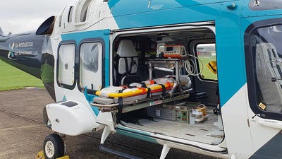
For the helicopter use case, the Lifeseeker unit now weighs less than 10kg. The RCAF’s Leonardo CH-149 Cormorant and Leonardo CH-146 Griffon helicopters are the primary rotary-wing aircraft used to respond to SAR in Canada. The Canadian Armed Forces have the primary responsibility for providing aeronautical SAR services to search for downed aircraft. But in the country, SAR is also a shared responsibility among federal, provincial and municipal organizations, as well as air, ground and maritime volunteer SAR organizations.
“The RCAF is only just beginning to roll out this [Lifeseeker] capability, and at this point it is somewhat operationally new,” the RCAF said. The air force annually provides military air resources in response to about 1,000 SAR events. The large Cormorant and Griffon helicopters can carry up to 12 stretchers and offer swift response times, hover and hoist capabilities, and dedicated SAR personnel. The shoe box-sized Lifeseeker technology would easily fit onboard. The RCAF Lockheed CC-130 Hercules is the fixed-wing aircraft used by dedicated SAR personnel to drop special equipment such as survival kits, including liferafts and shelters, to distressed people.
The Canadian SAR squadrons are strategically located throughout the country according to the historical distribution of distress incidents in order to ensure the quickest and most effective SAR response to the greatest number of potential incidents. The Canadian Armed Forces have about 140 SAR technicians. They are specialists who provide pre-hospital medical care and rescue for aviators and others in distress in remote or hard-to-reach areas across the vast country and its wildernesses.
Wearable devices
Satellite technology is still progressing, and beacons have been miniaturized, with some products available now to be worn on the wrist. Wearable PLB maker Mobit Telecom is an Israeli company that has coordinated two European Union (EU) Horizon research program projects for locator beacon technology. Worn on the wrist, the SAT406 model weighs 95g, is water resistant to three meters, will work for 24 hours, and can operate in temperatures from -20°C to +55°C. The company markets it as a good product for yachting, kayaking, parachuting, flying, mountaineering and skiing, among other pursuits. Mobit Telecom’s new product, SAT406M, is expected to be available next year.
The firm’s PLBs work with the international Cospas-Sarsat System, which uses 406MHz distress radio beacon technology and navigation satellites. From 2004 until this year, existing and developing satellite navigation constellations, for example the EU’s Galileo, have had SAR repeater payloads placed on the satellites. All the major global navigation satellite systems (GNSS), including Russia’s GLONASS, the USA’s Global Positioning System (GPS), and China’s BeiDou, have SAR repeaters onboard their spacecraft. The world’s GNSS orbit the Earth at an altitude of between 19,000 and 23,000km, a range considered to be medium Earth orbit (MEO). This ‘MEOSAR’ system of GNSS satellites was declared operational in 2016, with its full operational capabilities declared this year.
MEOSAR uses the SAR payloads, which are not vulnerable to jamming or spoofing
“MEOSAR uses the SAR payloads, which are not vulnerable to jamming or spoofing,” said Mobit Telecom Chief Executive Officer Daniel Katz.
The Mobit PLBs contain proprietary technology developed by Mobit called Single Burst Single Satellite Beacon Localization or SINSIN. This technology allows two-dimensional localization of a beacon based on a single burst sent by the PLB to a single MEOSAR satellite. Katz explained that this can enhance the time of arrival of SAR personnel for the MEOSAR service, but SINSIN has not been adopted yet by the Cospas-Sarsat System. In Katz’s view, the anti-jamming/spoofing characteristics of SINSIN, due to its single burst method of operation, would make it “more appealing to the military”. But for now, all of Mobit’s products are for the civilian market.

Tracking systems
Civilian or military, locator beacons are a requirement for much of the world’s aviation. In the USA, emergency locator transmitter (ELT) products are required for all aircraft and PLBs are popular among US aviators. But in the aviation community there is a third category that is growing in popularity, as the Aircraft Owners and Pilots Association (AOPA) Alaska Regional Manager, Tom George, explained: “That [third category] is other satellite devices that are becoming increasingly popular that have tracking and emergency response capabilities.” He is referring to the Garmin inReach product and New Zealand’s 15-year-old aircraft tracking service Spidertracks, which operates in 130 countries.
For AOPA members in the USA, the US government’s SAR operation is called the Search And Rescue Satellite Aided Tracking (SARSAT) system. It is operated by the National Oceanic and Atmospheric Administration (NOAA) and uses the 406MHz frequency for ELTs. Like the iPhone, an ELT will transmit to a SARSAT rescue coordination center if there is a higher-than-normal G-force impact by the aircraft. Due to false alarms, the US government now requires people to register their ELT with contact details. A quick phone call and a lack of any response helps indicate that it is a true emergency.
Personal locator beacons and their SAR networks continue to grow in geographical coverage, quality of signal and accuracy of location detection
Personal locator beacons and their SAR networks continue to grow in geographical coverage, quality of signal and accuracy of location detection. The achievement of full operational capability for the MEOSAR Cospas-Sarsat System, combined with the continued miniaturization of satellite telecommunication technology for smartphones, only makes the likelihood of PLBs becoming ubiquitous more likely. Whether it is military interest in civilian beacons and detectors or civilian interest in military technology, the speed at which victims can be located by SAR providers seems only to be faster with each generation.

December 2023
Issue
In the December edition, we cover personal locator beacons to aid with rescue; rescue operations in Mediterranean Sea; preparation for southern hemisphere fire seasons; and the value of sleep and rest for safe operations; plus more of our regular content.
Rob Coppinger
Rob Coppinger is a veteran aerospace writer whose work has appeared in Flight International, on the BBC, in The Engineer, Live Science, the Aviation Week Network and other publications. He has covered a wide range of subjects from aviation and aerospace technology to space exploration, information technology and engineering. In September 2021, Rob became the editor of SpaceFlight Magazine, a publication by the British Interplanetary Society. He is based in France.

