Lifesaving Mediterranean missions

In 2023 so far, more than 186,000 migrants and refugees successfully crossed the Mediterranean to Europe. But what of those who didn’t make the perilous journey? Search and rescue efforts in the Mediterranean are crucial to saving lives and as communications technology and assets continue to develop, the chance of rescue is improving for those lost at sea. Lauren Haigh investigates
According to the United Nations Refugee Agency UNHCR, in the first nine months of 2023 more than 2,500 people have died or gone missing in the Mediterranean Sea while trying to cross into Europe. The Central Mediterranean is widely considered to be the world’s deadliest sea border, but for those fleeing violence, insecurity and persecution, the treacherous journey is often their final hope. Search and rescue (SAR) in the Mediterranean involves coordinated efforts between various organizations, governments and humanitarian agencies to respond to distress calls, locate and rescue migrants and refugees in need, and provide medical assistance where required. Progress in SAR communications technology and assets is playing a crucial role in improving the chances of timely rescue by enabling faster, more accurate communication and coordination.
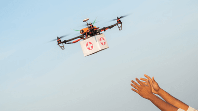
A key pillar of this is detection and monitoring, which involves aerial surveillance from aircraft and drones that monitor the sea for distress signals, stranded vessels and overcrowded boats. The technologies involved here are infrared cameras, radar and satellite imagery. Indeed, drones have gained significant traction in SAR operations, including in the Mediterranean, and as advancements in sensor technology – such as high-resolution cameras, thermal imaging cameras and radar systems – continue, these will become increasingly sophisticated.
In Spain, since 2018, engineers have been working to develop a specially adapted drone to assist with SAR operations in the Mediterranean Sea. Azamat Kinzyabaev, one of the developers, said: “It is a fixed-wing drone that carries a camera that records everything that it flies over and, when it sees a ship, it has a software that detects if it is a drifting ship and calculates the position in coordinates of longitude and latitude with a GPS.”
Meanwhile, a team at Chalmers University of Technology, Sweden, is developing a fully autonomous drone system with the potential to improve the efficiency and speed of response in rescue operations at sea. Xin Zhao, postdoctoral researcher in the Fluid Mechanics division at Chalmers, stated: “The project is based on the simple principle that different drones have different advantages, and by allowing several different types of autonomous drones to work together, search efficiency and rescue response speed can be significantly improved, with the potential to save more lives.”
SPONSORED CONTENT | UMS SKELDAR: RPAS FOR SAR
TECHNOLOGY TO AID MARITIME SEARCH AND RESCUE MISSIONS
The UMS Skeldar uncrewed aerial systems (UAS) are a perfect tool for any maritime mission – such as search and rescue (SAR) over water. Able to be equipped with a wide-range of sensors designed specifically to support SAR efforts that include optical radars, communication monitoring and intelligence (COMINT) receivers and more traditional electro-optical and infrared (EO/ IR) sensors, the V-200 is a very versatile tool for supporting search missions.
Offering real-time, autonomous small object detection and multiple lenses with a 360-degree view, optical radars can detect multiple small objects – beyond the capability of the human eye. The software that powers the system is an autonomous learning algorithm that can analyze the water’s surface, and identifies anything that is distinctly different from the natural environment – unaffected by white caps and other effects that impede radar. It can send a thumbnail and location on a map to the aircraft’s mission system where operators can view it, determine their interest and then initiate a cue for closer investigation.
The COMINT receivers are capable of picking up signals from mobile phones and sim card enabled devices, even in areas with no network coverage as the system creates its own network.
Emergency position-indicating radio beacon (EPIRB) receivers can also be fitted to our UAS.
Given the multiple payload bays that our platforms are fitted with and a total payload capacity of more than 40kg, SAR operators can configure the UAS in a way that is normally only found on crewed aircraft. The ability to carry the right sets of sensors of the right quality drastically shortens search times and eases the workload of an operator. This, combined with an unbeatable endurance, makes the platform an excellent complement to a crewed fleet of aircraft giving that extra search capability needed in a safe and efficient manner on the most demanding missions and to save more lives.
Range and endurance
The UMS Skeldar UAS offers extended range and endurance times exceeding six hours (depending on payload) making them a workhorse in harsh maritime environments where long endurance times are key to completing missions when lives are at stake.
Benefits for surveillance and search missions
Our UAS fitted with, for example, a combination of a high performance EO/ IR sensor, optical or a traditional sea radar, a COMINT receiver and an automatic identification system transponder is an excellent tool for performing search missions both over land and sea due to its automated flight characteristics, long endurance and range, and ability to carry multiple payloads. The configuration provides real actionable intelligence to the rescue forces on the ground, on the sea or in the air. Being able to do this while not risking the lives of pilots or onboard crew during the harsh weather and low visibility typically found during SAR missions is a invaluable benefit. It also means that an operator can focus better on finding missing people, rescuing lives and the mission itself.
Different drones have different advantages, and by allowing several different types of autonomous drones to work together, search efficiency and rescue response speed can be significantly improved
Uniting the ‘search’ with the ‘rescue’
Médecins Sans Frontières/Doctors Without Borders (MSF) has its own rescue ship called Geo Barents to save lives in the Central Mediterranean and provide emergency medical care to survivors. This year, 2023, is the 10th consecutive year that MSF has launched SAR operations in the Mediterranean. AirMed&Rescue spoke with Fulvia Conte, MSF Search and Rescue Team Leader on Geo Barents, about how progress in assets and communications tech is improving SAR capabilities. “I would say comms technology mostly improves the ‘search’ part, rather than the ‘rescue’ phase,” she said. “Progress in internet communications and devices are very helpful when it comes to tracking other assets such as other boats and/or aerial assets, as their presence in the sky can also often indicate boats in distress in the area at sea. More developed and sensitive radars, as well as bridge tools, enable us to have more precision about the positions and movements of the other assets, and thus to find the potential boats in distress more easily. For instance, during the last rotation we performed in mid-September, we identified a boat in distress at night, thanks to an echo on the ship’s radar; we could probably never have seen it otherwise. Thanks to improved communications tools, we can also maintain a better connection between the people that stay on the bridge (main control center) and those on the rigid-hulled inflatable boats (RHIBs), which allows us to perform long-range rescues with the RHIBs, arriving faster to the boats in distress. In those kinds of operations, we use VHF radios, as well as a sat phone which ensures that we always have a last-resort option of communication between the bridge and the RHIBs in case the radio/VHF signal gets lost.”

Of course, communication works both ways and Tamino Bohm, Tactical Coordinator, Sea-Watch Airborne, highlighted how improvements are helping migrants and refugees to communicate: “Some boats are equipped with Thuraya satellite phones and people would mostly call the network Watch the Med – Alarm Phone, a 24/7 distress hotline for people on the move in the Mediterranean Sea.”
Conte agreed: “There are greater possibilities for survivors to communicate directly with Alarm Phone, giving their GPS position at a certain time, which is something that has significantly improved the information we have about the exact positions of the boats in distress, and how quickly the distress messages are relayed to the authorities or other vessels around. Generally speaking, internet and IT tools also facilitate better collaboration between SAR non-governmental organizations.”
It’s obvious that assets and comms are getting better lately since technology is improving at a very fast speed
Safety is paramount
AirMed&Rescue also spoke with Cristiano Aranda Flaminio, SAR Captain with the Spanish Coast Guard SASEMAR, who pointed out that regulations can be a sticking point for new advancements: “It’s obvious that assets and comms are getting better lately since technology is improving at a very fast speed, not only related to SAR operations. However, due to agency regulations, everything has to be at a slower speed in order to prove them against any aircraft system interference. Safety is very important when trying new technologies and, in general, aircraft systems are way too expensive so neither the agencies nor the factories are willing to spend that amount of money to make assets and comms slightly better. The operators are the ones most involved directly in the operations but, again, with limited resources to prove new technologies.
“The best assets we have are normally the ones used previously in the military, such as FLIR [forward-looking infrared] and NVG [night vision goggles]. If we consider the known assets, proven and tested in the military and now used in civilian aircraft, it’s clear that the chances are enhanced by high numbers. Most of our searches, especially the ones at night, are only possible due to the infrared technology.” Indeed, IR technology has become an invaluable tool for enhancing the chances of locating and rescuing individuals in distress, especially under challenging environmental conditions.
Most of our searches, especially the ones at night, are only possible due to the infrared technology
Sea-Watch is a German non-governmental organization that conducts SAR operations in the Mediterranean. It operates rescue vessels and aircraft and has been involved in numerous rescue missions, particularly on the Central Mediterranean route. Bohm shared with AirMed&Rescue the inspiration behind the creation of Sea-Watch’s Airborne division: “It came about from a learning we made in 2015. While our first ship, the MV Sea-Watch, was in the area of operation northwest of Tripoli, we spotted and consequently embarked around 120 people from an unseaworthy and overcrowded rubber boat. After we took the people onboard, they told us that they had been adrift for three days already as their engine broke down. We have been in the area close to them for all three days before but did not see them. It became obvious that a civil eye in the sky is needed to locate these people. In June 2015 it was not yet clear how this idea could materialize and, in 2016, mainly different kinds of airplanes were tested in different flight envelopes, so it got more precise. In April 2017 we launched Operation Moonbird, the first and only civilian search and rescue airplane to be operated worldwide at that moment.”

A needle in a haystack
In the future, SAR operations in the Mediterranean are likely to benefit from continued advancements in technology, including improved communication systems, autonomous aerial vehicles, and enhanced coordination among Mediterranean nations
Flaminio also shared a success story: “We operate from Mallorca SAR base and most of our refugee rescues originate from Algeria. They normally arrive in boats and always with life vests. It’s not unusual to be overcrowded and the boats are in poor condition. Once we had a situation where there were many changes in the wind and sea conditions and they ended up staying in the boat for six days. The wind was blowing them in a way where they were about 25 miles from the coast but from where they could see the mountains. From their desperation, I assume, this created a false idea that they could swim in order to reach the coast – far from reality. We arrived at the scene and, to our surprise, seven of them – four without life vests – were already in the water. There is zero chance of survival in such conditions but in the end we managed to rescue them all, with a little bit of luck since they were all spread around in the water and we could find them all. No specific asset was used in this case, just good attention looking outside for them.”
Bohm explained the extent to which technological enhancements are improving the chance of rescue for refugees crossing the Mediterranean Sea. “To locate people in distress is crucial to their rescue. To launch a rescue operation without a clear idea of the situation and type of distress, as well as their location, is nearly impossible and has very little chances for success, as you are searching for a needle in a haystack. This is one of the reasons why we started our civil reconnaissance flights in 2017, to proactively search for boat people in distress and not just react to information received – thereby adding the ‘search’ to the ‘rescue’ and completing SAR.”
In the future, SAR operations in the Mediterranean are likely to benefit from continued advancements in technology, including improved communication systems, autonomous aerial vehicles, and enhanced coordination among Mediterranean nations. For example, drones will become increasingly versatile and sophisticated while advances in satellite technology will enhance the frequency and resolution of imagery, enabling faster detection of vessels in distress.
SPONSORED CONTENT | FLYSIGHT: OPENSIGHT FOR SEARCH AND RESCUE
OPENSIGHT EASILY INTEGRATES WITH SEARCH AND RESCUE SYSTEMS
Using the highly advanced OPENSIGHT solution, FlySight and Smith Myers have joined forces to deliver ARTEMIS – the mobile phone detection, location and communication system – to search and rescue (SAR) teams around the globe. By integrating ARTEMIS and OPENSIGHT, operators can get a much clearer operational picture of any scenario. Using the advanced augmented reality software, the information gathered from ARTEMIS can be overlaid and accurately rendered into a 3D map. This gives ground-based SAR teams a more in-depth understanding of the terrain, allowing them to choose the safest and/or fastest route to the target. So, not only does the ARTEMIS/ OPENSIGHT combination provide a faster rescue for the target, but it ensures the safety of SAR teams, both on the ground and in the air.
Whether it’s a mountain rescue or a coastal search, any system that allows SAR teams to locate the exact position of their target quickly has a massive impact on a successful outcome. ARTEMIS and OPENSIGHT could revolutionise modern SAR tactics and, consequently, save countless lives in the future. Furthermore, OPENSIGHT image processing capabilities allow to enhance the quality of the image, ensuring that the SAR teams can get a much more detailed overview of the terrain from an airborne SAR unit.
OPENSIGHT fits onto existing platforms and operating systems
Thanks to its multi-platform and multi-operating system vocation, OPENSIGHT can be configured and installed onto many different targets. According to the specific user requirements, customers can decide to install OPENSIGHT on an already available mission computer, or to configure it on a handheld tablet, that can be easily brought onboard according to the specific mission.
Complete support from FlySight
FlySight provides full support to operators in leveraging this new technology. Expert OPENSIGHT technicians assist throughout the entire process, from installation to training and ongoing support. They ensure that operators receive personalized assistance to optimize, adapt and modulate the best OPENSIGHT for maximum efficiency and effectiveness in the situational awareness phase, thereby expediting the overall effectiveness of SAR operations. FlySight are available for live demonstrations whenever you want!

December 2023
Issue
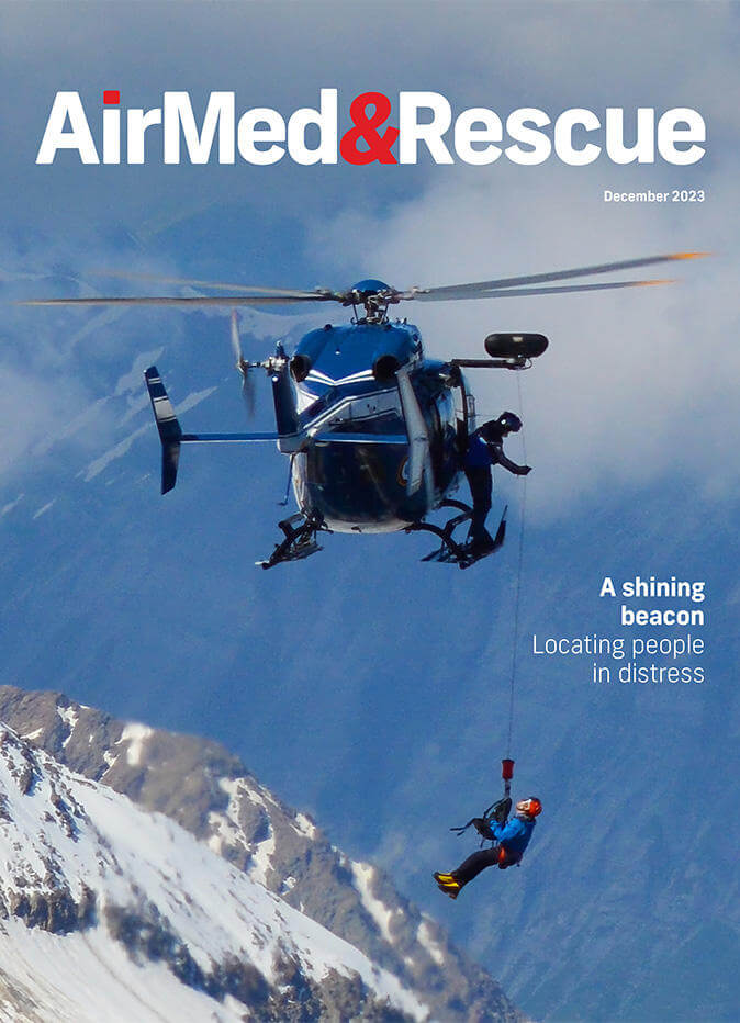
In the December edition, we cover personal locator beacons to aid with rescue; rescue operations in Mediterranean Sea; preparation for southern hemisphere fire seasons; and the value of sleep and rest for safe operations; plus more of our regular content.
Lauren Haigh
Lauren has worked in the publishing industry for eight years and reads and writes about healthcare, science and travel insurance on a daily basis. Her favourite aircraft is the plane from the title sequence of British educational children’s TV series Come Outside.

