Are UAVs the future of search and rescue?

Oisin McGrath discusses the development of an app that could revolutionise how search and rescue missions are carried out
The team
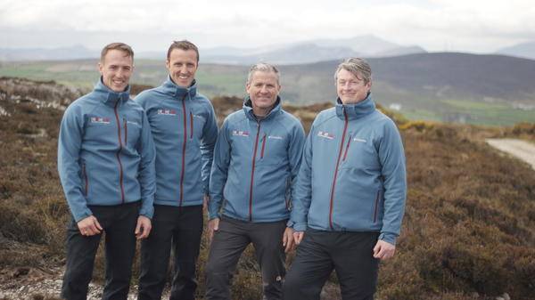
DroneSAR was established as a direct result of the collaborative input of four individuals (pictured above) who each possess expertise and skill-sets that are specific to the world of drone technology, network and satellite communication and search and rescue (SAR) co-ordination and emergency response. I am a military helicopter instructor, unmanned aircraft examiner and has a degree in Aeronautical engineering; Matthew Kelly is an award-winning app developer and mountain rescue volunteer. He also has degrees in electronics and satellite communications. Leo Murray is Deputy Team Leader in Donegal Mountain rescue and has a background in product research and design, and Gearoid O’Briain is currently on a scholarship in Smurfit Business school completing his MBA. He is also a military manned and unmanned aircraft instructor.
The mission
Drone advancements in recent years have resulted in an increased capacity for unmanned vehicles to take on a range of dangerous tasks in emergency response that would traditionally have been performed by humans.
The DroneSAR product is the first worldwide to include rescue-specific functions including live drone tracker and live first person view (FPV) video streaming made viewable from any location via the DroneSAR web-browser interface. Return on Investment (ROI) to the emergency response and SAR industry is reflected in potential savings resulting from a decreased reliance on conventional solutions involving manned aerial assets such as helicopters and fixed-wing aircraft, where hourly rental rates of up to €3,000 per hour exist. This allows rescue agencies to conduct the most effective early stage aerial search so that lives can be saved. The software could also be influential in the global use of drone technology for emergency management, response and damage mitigation as it will reduce the exposure to risk that emergency agencies are continually facing in their response duties, reduce the time taken to locate missing persons and ultimately reduce the cost of providing the emergency response service.
Usability
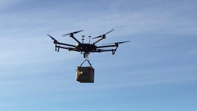
DroneSAR is designed to rapidly execute autonomous aerial search patterns, capture and relay live drone video and offer a FPV solution for incident command when co-ordinating emergency first response. DroneSAR enables commercially available off-the-shelf (ie, affordable) drones to perform a range of rescue-specific functions.
At its most basic level, DroneSAR allows drone pilots to easily choose automatic flight patterns for early stage aerial search. Primary aerial reconnaissance will involve searches along handrail features such as tree lines, walls, tracks and streams. Our waypoint mission function allows the pilot to choose these missions, autonomously flying the drone while he/she can concentrate on watching the live video. For more open areas, pilots can choose custom grid patterns to ensure nothing is missed for much larger search areas. During the flight, pilots can drop pins for areas of interest and if something is found, they can share the drone location to pre-entered team members, thus allowing them to stop and reassign resources to make the rescue.

At the next level, DroneSAR allows command and control to view live drone position and live video from any internet browser. The live stream function allows incident control and search management to remotely track the drone, and obtain an ‘in the moment’ FPV of its search patterns and captured high-definition footage, which is fed through to connected devices (smartphones, laptops and monitoring screens) located either in the vicinity of the incident area or remotely to other search managers at national and regional control centres.
What does the future hold?
To date, DroneSAR has been successful in the Enterprise Ireland Competitive Start fund. This gave us the capital and the support to bring the project forward and allows us to increase our financial input from the European Space Agency in the form of project funding opportunities that were aligned with our company direction.
Following our wins at the Copernicus Masters Competition and the Copernicus Incubator Programme, we are seeking to deliver a complementary fusion of drone data collected by the DroneSAR platform and the interactive geospatial satellite data accessed through the Copernicus Emergency Management System, which will seek to ensure that UAVs can be used methodically as part of a rescue protocol during emergency and disaster response. This will allow pilots to receive up-to-date satellite images following disasters to allow them to make better-informed decisions on their search patterns. We have developed a recent partnership with AstroSAT, a Scottish company who are leading the way in satellite data transfer, and aim to integrate their Recovery and Protection in Disaster (RAPID) with HD video and images supplied by DroneSAR. will be trialed in Vietnam in the coming months.

October 2018
Issue
In this issue:
Swiftwater rescues part II - Europeans do it differently
Always moving forward - Next-gen aircraft medical interiors
Mixed reality – the future of emergency medic training - Virtual training combined with reality – the best of both worlds
Generation X - The future of USAF combat rescue helicopters
Data incoming - Developments in the fast-paced world of aviation communications and technology
Interviews:
Dave Kelly - Co-Pilot, Essex & Herts Air Ambulance
Mark Delaney - General Manager, Toll Helicopters
Medical Insight: High oxygen, low altitude -Hypoxic respiratory failure and the effects of cabin pressurisation on patients with respiratory conditions
DroneSAR - Are UAVs the future of SAR?
Provider Profiles:
AeroMD -International air ambulance service based in the US Virgin Islands
California Highway Patrol Air Division - SAR, air ambulance and law enforcement, all in one
Oisin McGrath
Oisin McGrath, has over 18 years in the aviation industry, including a 1st class honours degree in Aeronautical Engineering and is currently serving as a Military helicopter instructor and examiner for the H135. He has experience across a range of roles such as Special Forces Ops, Police Air Support & Air Ambulance. Oisin has a passion for unmanned aircraft technology and is co-founder of Irelands leading unmanned aircraft training centre, FlyRyte Drone Academy and is a National Authority approved unmanned aircraft instructor and examiner.

